And what country can preserve its liberties if their rulers are not warned from time to time that their people preserve the spirit of resistance? Let them take arms. The remedy is to set them right as to facts, pardon and pacify them. What signify a few lives lost in a century or two? The tree of liberty must be refreshed from time to time with the blood of patriots and tyrants.
Thursday, December 28, 2023
Arizona Classic. I wonder what this looks like now?
Speedy's Truck Stop looks a lot like what this turned into. The building foundations are the right size, shape, and orientation, and the fueling area is in the same place (building replaced by a carport roof of the same size and shape). Nothing else in town matches it as well.
And (if you're using Google Earth Pro) if you go down to the ground and tip the scene, the canyon wall behind the place looks the same. I'm 99% sure that this is Speedy's now.
if my health holds i'm going to be making a trip through that area this spring. gonna haul ass to Albuquerque and turn north on the 2 lanes for about 3 weeks and avoid the 4 lane Hwy's AMAP. thats the plan as it stands now, wish me luck. thats home to me but i have not seen it for a long time now.
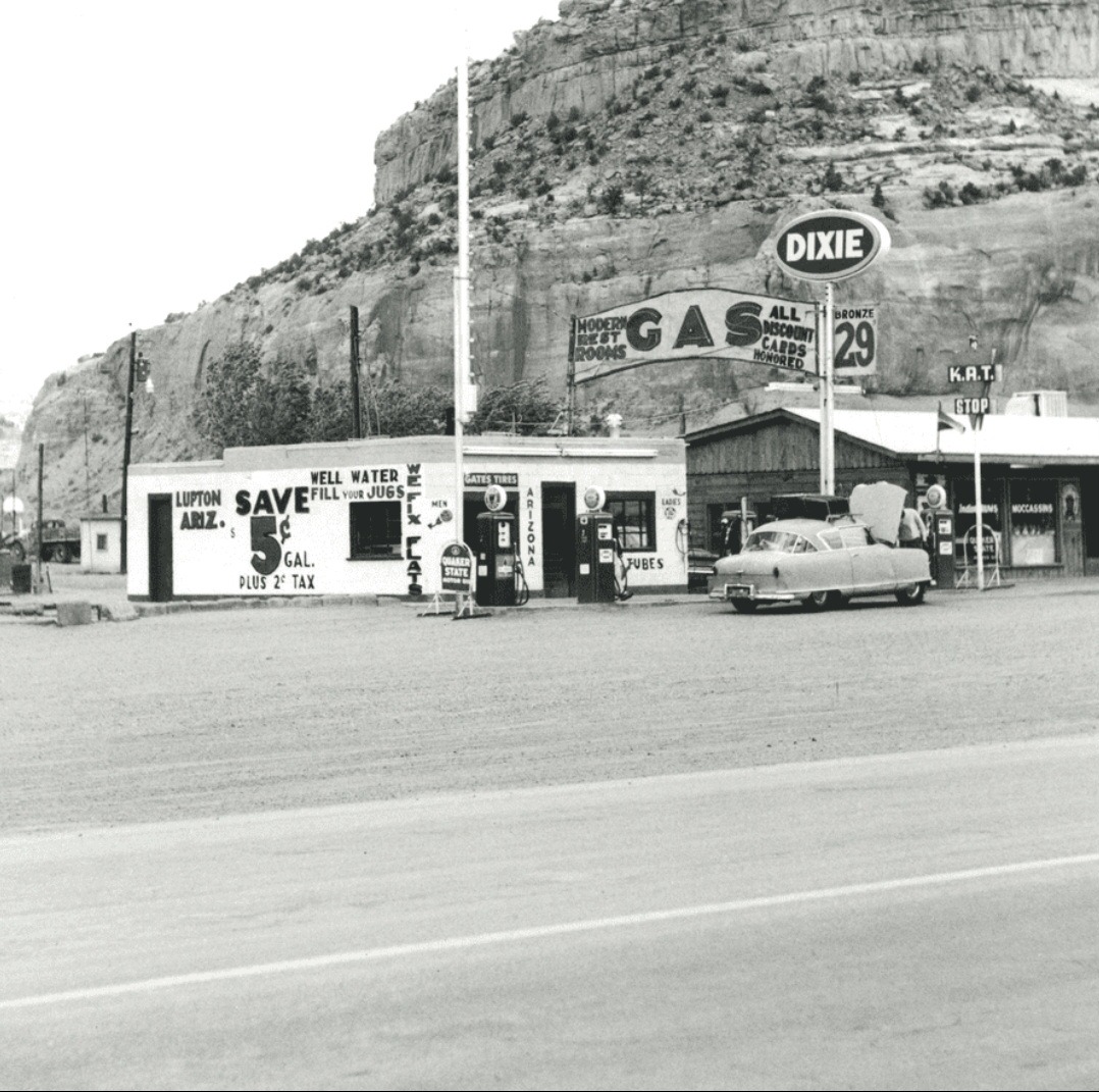
Lupton, AZ on Google Maps - where I-40 AZ enters NM. Street view shows the entire area nicely. A lot of fun old Rt 66 stuff in this area.
ReplyDeleteA Google map search for Lupton produces this: http://tinyurl.com/2dxd8u67
DeleteIs this the location that has tepees on the hill side?
ReplyDeleteThat Nash looks a lot like my Dad's 'train car'. Used to go to the train into NYC.
ReplyDeleteSpeedy's Truck Stop looks a lot like what this turned into. The building foundations are the right size, shape, and orientation, and the fueling area is in the same place (building replaced by a carport roof of the same size and shape). Nothing else in town matches it as well.
ReplyDeleteAnd (if you're using Google Earth Pro) if you go down to the ground and tip the scene, the canyon wall behind the place looks the same. I'm 99% sure that this is Speedy's now.
I don't know. It sorta looks more like where the Stateline General Store is -- which looks like an old converted gas station.
DeleteCould be, but I'll leave my money on Speedy's based on the camera angle of the cliffs. Next time I go through Lupton, I'll ask some old guy ;-)
DeleteInvaded and overwhelmed:
ReplyDeletehttps://www.foxnews.com/us/arizona-border-rancher-saw-ms-13-ranch-dire-warning-cartel-scouts-mountains
if my health holds i'm going to be making a trip through that area this spring.
ReplyDeletegonna haul ass to Albuquerque and turn north on the 2 lanes for about 3 weeks and avoid the 4 lane Hwy's AMAP. thats the plan as it stands now, wish me luck.
thats home to me but i have not seen it for a long time now.